
Towpath An app by Ectopistes
Find your way
to the Towpath.
Explore the Ohio & Erie Canal Towpath Trail with dependable information about trail access, parking, places to discover, and manually reviewed trail conditions.
Preparing for private beta.
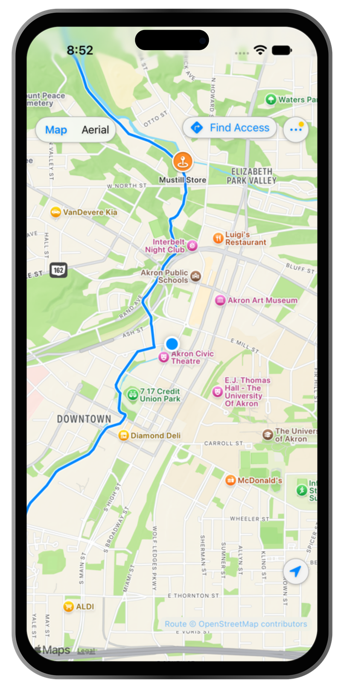
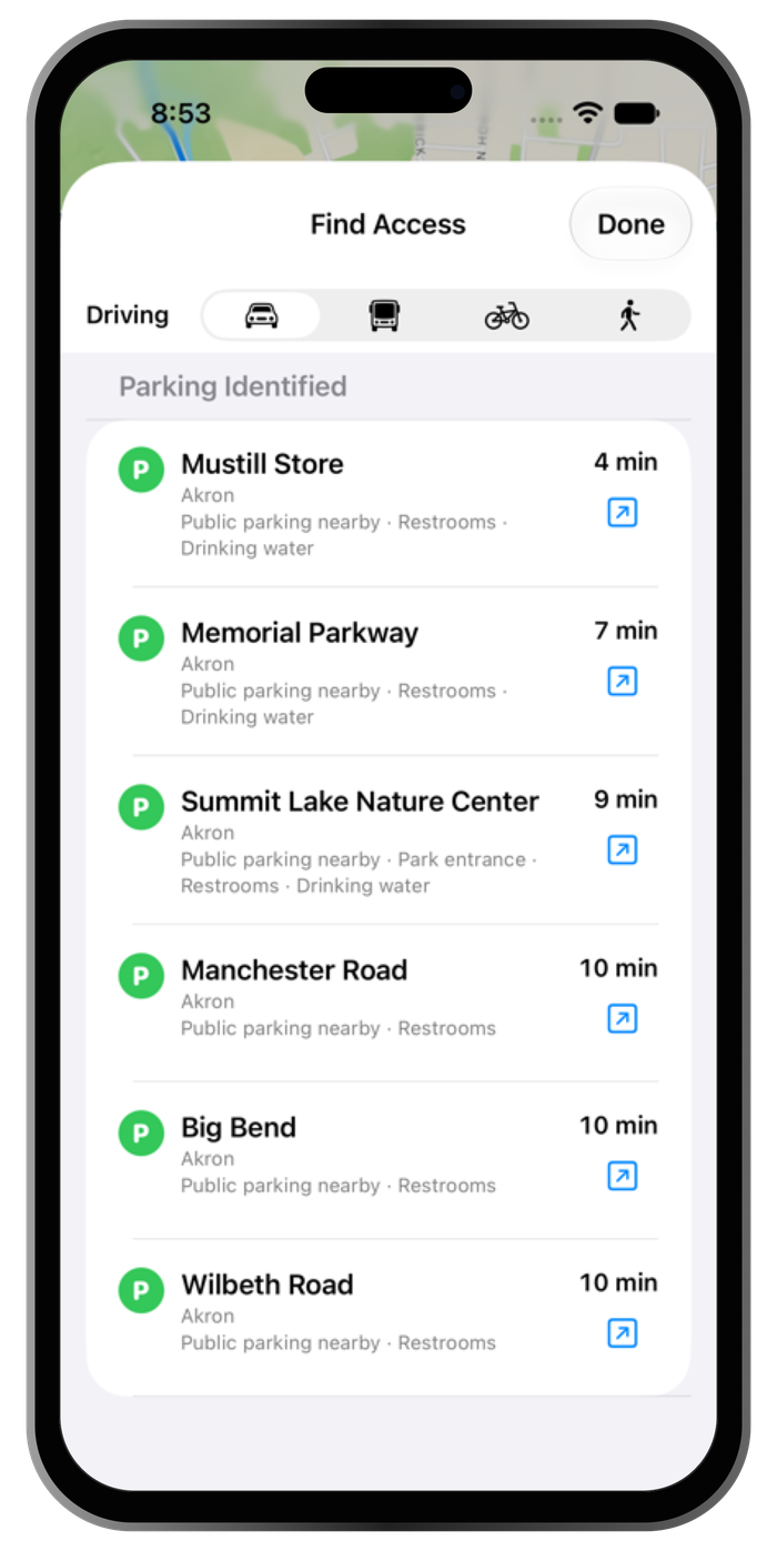
Find your start.
Find a reviewed trail access location, check public parking information, and compare estimated driving times with Find Access. Open directions in Apple Maps when you’re ready to go.
Some access and parking details are still subject to verification. Check the information for your chosen location before setting out.
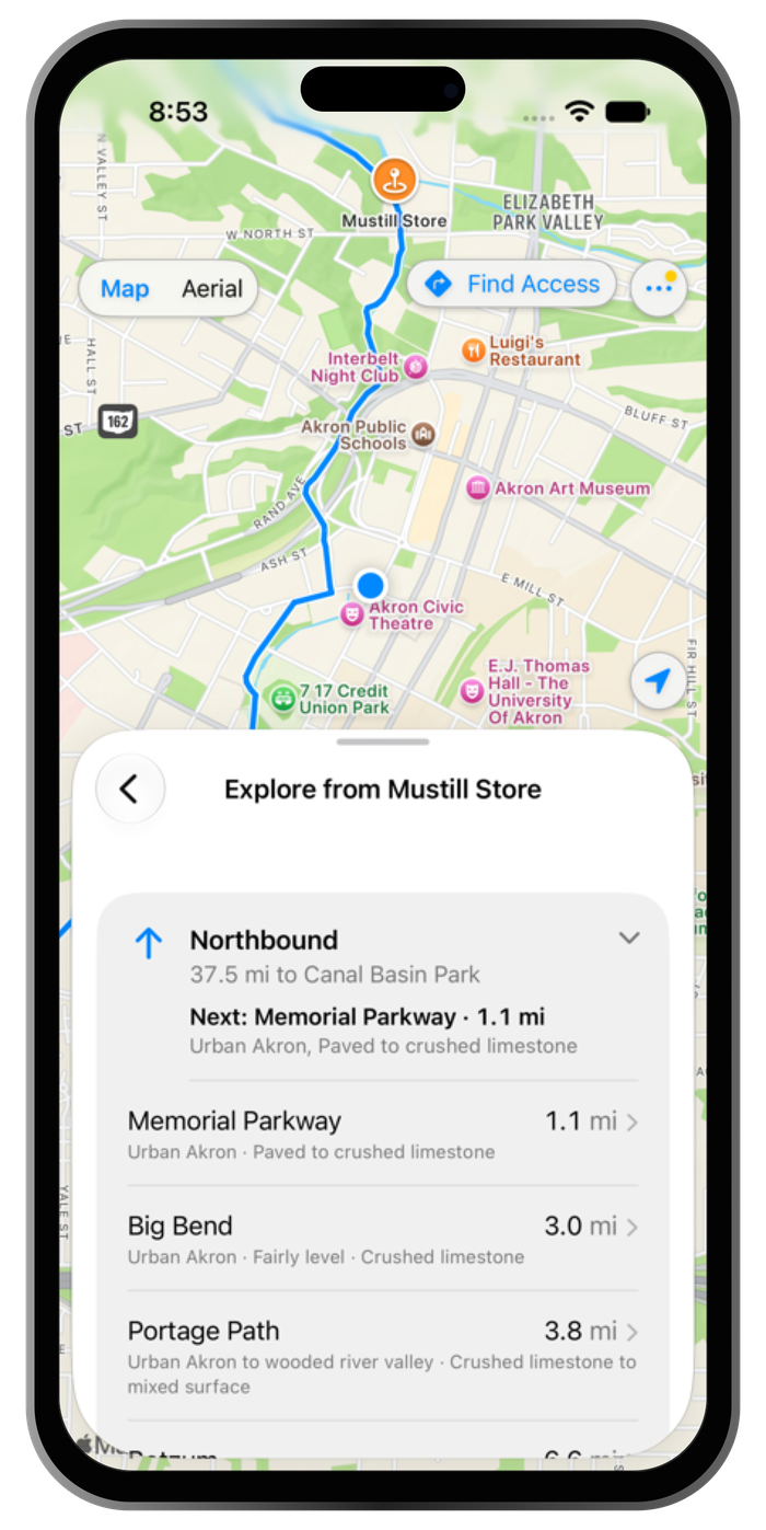
Explore the trail.
Browse the Towpath corridor on an interactive map, with useful trail amenities and nearby places along the way. Explore from Here offers trail-distance estimates to help you consider where to go next.
Towpath helps you plan your visit. It does not provide turn-by-turn cycling or hiking navigation, and offline maps are not included.
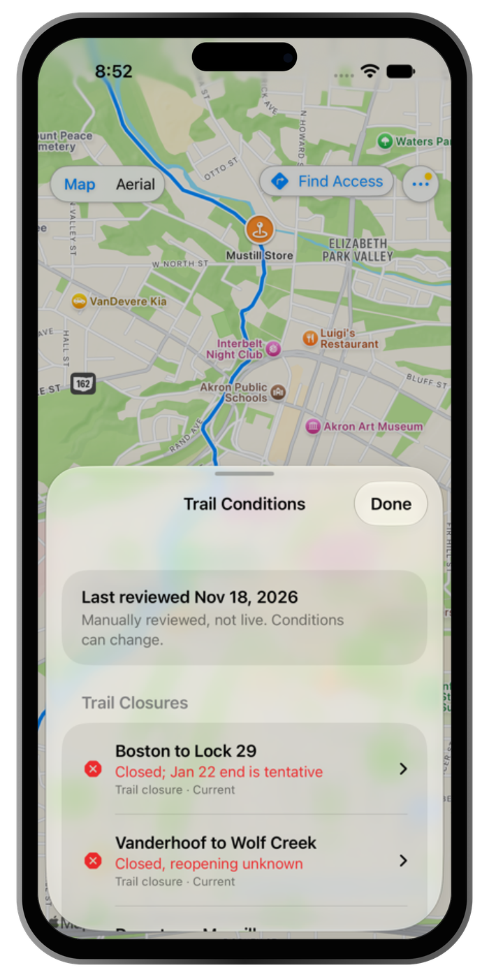
Know before
you go.
Trail Conditions brings together manually reviewed closures and advisories, with source information and verification dates so you can see what was checked and when.
These are reviewed reports, not live updates. Conditions and accessibility can change. Check current official trail information before your visit.
Simple by design.
No account. No advertising. No Ectopistes behavioral tracking.
Apple Maps processes map and routing requests to provide those services. The Towpath Privacy Policy explains how location information, Apple services, and device preferences are handled.
Preparing for private beta.
We’re preparing Towpath for private beta testing as we review the trail information and refine the experience.